We three friends decided to spend our short vacation with the road trip of a lifetime; as far as we are concerned. And it was such an awesome experience that I am still gloomy after returning.
We had to work on a very tight schedule and there were reports telling me that the monsoon is very heavy in coastal Karnataka, it's a very bad time to visit Goa, etc. Anyway, we took a risk and drove 850 km through the western coastal line of India and it turned out to be more than worth taking it.
To Goa
We started from Cochin at around 6pm on 5.7.2012, Thursday. Odd time maybe, but I love driving at night and we had to see coastal Karnataka in the morning.
Kerala
Cochin ---> Thrissur ---> Calicut ---> Mahe ---> Kannur ---> Kasargod ---> Manjeshwar
Length of this segment :- Around 400 km
Road conditions :- Exceptionally good for almost 90% of the segment. Mahe area is horrible. Calicut - Kannur segment has got many unpredictable dividers with no warning signs which may turn deadly at night.
The journey was through NH 66, previously known as NH 17. There were boards with both the old and the new names and may create unnecessary confusions for many.
The bottom line is NH 66 = NH 17.
Almost 90% of the road in this segment was excellent. Except for a few kilometers of bumpy rides in Mahe, it was a very comfortable journey. We had dinner from Hotel City Light Restaurant, Calicut (Reached Calicut by 10.30pm). I knew of this place before. It's open till 12.30 AM and the food is very cheap and scrumptious. It's in Meenchantha, Calicut.

Calicut to Kannur segment is 96km. NH 66 here was not that excellent as compared to the areas in the South, but still it was very good. Only problem I found was the unpredictable dividers with no flourescent lights. It was quite dangerous,especially whilst overtaking.
After Payyannur in Kannur, we reached Kasargod. Kasargod is the northernmost district of Kerala, lying 50 km south of Mangalore. Kasargod City is virtually on top of a small hill and we had to traverse up hill for about 3-5 km to reach there. This sector had numerous potholes and a few hairpins. Kasargod district is the district in India with the maximum number of languages spoken. There is Malayalam, Kannada, Tulu, Konkani, Hindi, Byari, etc. The Malayalam spoken here is absolutely different to that of anywhere else in Kerala and is hugely influenced by Kannada and Tulu.
Kasargod to Mangalore is just 50km The Kerala border is Manjeshwar.
Karnataka
Talapady ---> Mangalore ---> Suratkal ---> Udupi ---> Kundapura ---> Bhatkal ---> Honavar ---> Karwar.
Length of the segment :- Around 300 km.
Road conditions:- Reasonably good, except for short stretches of bumpy rides. Currently construction works are going on from Surathkal to Kundapura, but it won't be a problem by any means.
We were surprised that there was no real border checkpost here. I don't know if it's because of the time , but it felt funny that we didn't any single policeman on the border. :D
The initial Karnataka segment started giving second thoughts to us. The road (NH 66) was awful till Mangalore City (about 25 km).
We reached Mangalore by about 3 AM after crossing the Netravati River. One IndiaMike member had before told me that Mangalore to Kundapura route (about 100km) is under construction. But it won't cause much trouble at all. But you ought to drive slow and safe, especially during night. Mangalore to Panaji is about 390 km.
By 4.30 AM we reached nearby NIT Suratkal and about 1 hour later, Udupi.
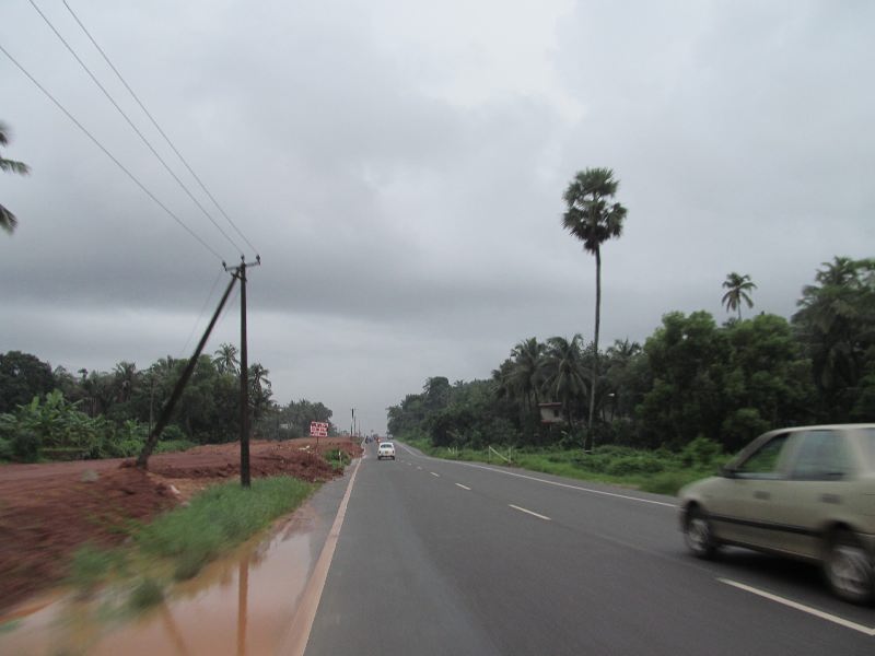
NH 66, near Surathkal
We finished the journey through the road construction areas by early morning when we reached Kundapura.
The real coastal Karnataka begins after Kundapura and it's simply mindblowing. Most of the landscape strikes extreme similarity to parts of Kerala. But I don't think there is any NH in Kerala that runs inches closer to the sea like this one pictured below :-

NH 66, just after Kundapura.
Kundapura to Bhatkal is around 60km. These are state of the art coastal areas with Konkan railways running sideways. The condition of the road was very good, even during this Monsoon season.

NH 66, Kundapura<-->Bhatkal Segment.
In Bhatkal, there is the famous Murudeswar temple and the Shiva statue. The temple can be seen while travelling if you look carefully to the west. After about 30-40 min, we reached Honavar by 7.30 AM after crossing Sharavathi River. I am not zen percent sure that it was Sharavathi, but my intuition tells me so.
Honavar is the biggest city in between Udupi and Karnataka-Goa border. We had breakfast from there and there were many restaurants open at that time. The diversion to Jog Falls is from Honavar.
Karwar is about 90-100 km from Honavar.

NH 66, Honavar<-->Karwar segment.
Karwar is on the Karnataka-Goa border and is famous for it's fishing industries and an Indian Naval Base. There were a few beaches and small islands on the sea, almost like an archipelago. We reached there (Karwar) by around 10 AM on 6.7.2012 (16 hours from Cochin).
After a few minutes, we reached the Karnataka-Goa border. There was no checking. A Karnataka policeman stopped us and asked to give him Rs. 100 as an entry fee into Karnataka :D. He had no receipts whatsoever [whoa]
Goa
Karnataka-Goa Border near Karwar ---> Madgaon ---> Panaji ---> Calangute
Length of the segment :- 110 km
Road conditions - One of the best in the whole of India. The only drawback is that roads are not that wide enough to contain the busy traffic.
NH 66 in Goa is sheer world class! There are some few areas where it is narrow, but it is quite easily manageable and there are no pot holes whatsoever throughout Goa. Madgaon is 70 km from the Karnataka-Goa border. The environment is absolutely marvelous and is almost like a carbon copy of Kerala.

NH 66, Karwar<-->Madgaon segment.
The Police was very strict in Goa. Always have the up to date documents with you. That includes the pollution certificate. Google Navigation was extremely helpful for us and it works like a charm in Goa, even in the most remote places.
Madgaon is in South Goa and is a very congested place and there is busy traffic. Many locals don't understand 'Panaji'; they only know 'Panjim'. Panaji is 35km from Madgaon. Again, the NH 66 here is of world class quality. But remember, it's almost always busy, even outside Madgaon and Panaji, and that too in an off-season like during Monsoon. The traffic and the premises are remniscent of Kerala.
From online, I read about Calangute and Baga beaches and we headed for Calangute in North Goa. Panaji to Calangute is 14 km. We reached there by 1 PM on 6.7.2012 (19 hours from Cochin).
Goa
We had absolutely no clue about the stay in Goa. This was my first time in Goa. Though it was off-season, the Calangute area was very busy with myriads of tourists in every nook and corner of the streets. The roads there were very narrow and driving a car will not be like a daily routine. Almost all are riding two-wheelers/bicycles. It took some time to find an affordable room and I think we got the best deal ever.

Our stay
It was more like a home stay. The place is in Calangute, on the road to Baga beach. The house owner's name is also Martins, a very congenial well-to-do person of about 60 years of age. What impressed me is that he wasn't gloating about the quality of the rooms. Nor did he force/plead us to take the rooms. He has got about 10 rooms to my knowledge. He and his family lives in the building too. We didn't have any brokers and it was like a divine intervention. There is one reasonably big bed room with TV , a separate kitchen equipped with fridge,microwave oven and a clean bathroom with heater. There is space for parking one car. Surprisingly, it was just Rs. 300 per head for non-AC and Rs. 400 per head for AC. He also offers beer, cool drinks, mineral water, morning coffee/tea, two-wheelers for rents, etc. It was so strange that the rates for these were very less. Infact, it's the cheapest if you compare it with the rates of restaurants nearby.
The tariffs may go higher during season, though.

The location of our stay was in a very strategic spot. Both Baga and Calangute beaches are only a few minutes walk away. :)
Restaurants in Calangute were mostly very costly, even though it was an off-season.
The next morning (7.7.2012) we went to Basilica of Bom Jesus in Old Goa where the body of St. Francis Xavier is kept. Google Navigation is a must if you're planning to reach there without much fuss. It's about 25 km from Calangute and 9 km from Panaji.


Basilica of Bom Jesus, Old Goa
Later, we went to Vasco. Vasco (or Mormugao) is where the Airport is. There is also a massive harbour there. Vasco is in South Goa and is about 30 km south-west of Panaji.

View of the Harbour,Vasco (Mormugao).

A ship in the harbour, Vasco
From Vasco we went to Colva beach in South Goa; the distance was about 30km. On the way is the industrial areas of Goa and a beautiful BITS Pilani Goa Campus. Again, the Google Navigation proved to be extremely handy.

Colva Beach
The weather in Goa was extremely pleasant, except for some occassional rainfalls.
Back to Cochin
We departed from Calangute on 8.7.2012 at 7 AM through the same route. The traffic was not at all busy in Goa during early morning as opposed to the hectic congestion we experienced afternoon on the previous day.

Just after Goa-Karnataka border
We reached Honavar from Calangute(200 km) by 12 noon. Jog Falls was just 60 km east of Honavar and it felt like we will be ruing the decision to opt for not seeing India's 2nd tallest water falls if we did so. So, we took this diversion to see Jog Falls. We were a bit worried about the condition of the road, but were totally wrong.
Honavar to Jog Falls is 60 km. It was a joy to drive through the Sharavathi Forest areas of Western Ghats. The first half of this route was via very good wide roads. The last half was through dense forests and the road was very narrow, but the condition was alright. Not a steep up hill journey by any means.

Honavar<-->Jog route
It took 100 minutes to reach Jog Falls from Honavar (60 km). But the return journey was much shorter.
Jog Falls is the 2nd tallest water falls in India. I have seen pictures of Jog Falls with a lot of thick marauding streams. But except during Monsoon, it will reduce to only a handful of thin streams. The expectations were, since, high. But we saw only a few thin streams. Monsoon is not at all strong in 2012.

Jog Falls on 8.7.2012.
The trip was virtually over by this time. We went back to Honavar and from there we took the same route down South via NH 66 to Cochin. We reached Cochin at 6 AM on 9.7.2012. Return journey took 23 hours (because we diverted from NH 66 to see Jog).
We got to see almost the entire western Indian coastal areas, enrapturing every moment of the journey. The Western Ghats and the Jog Falls proved to be an icing on the cake. :)